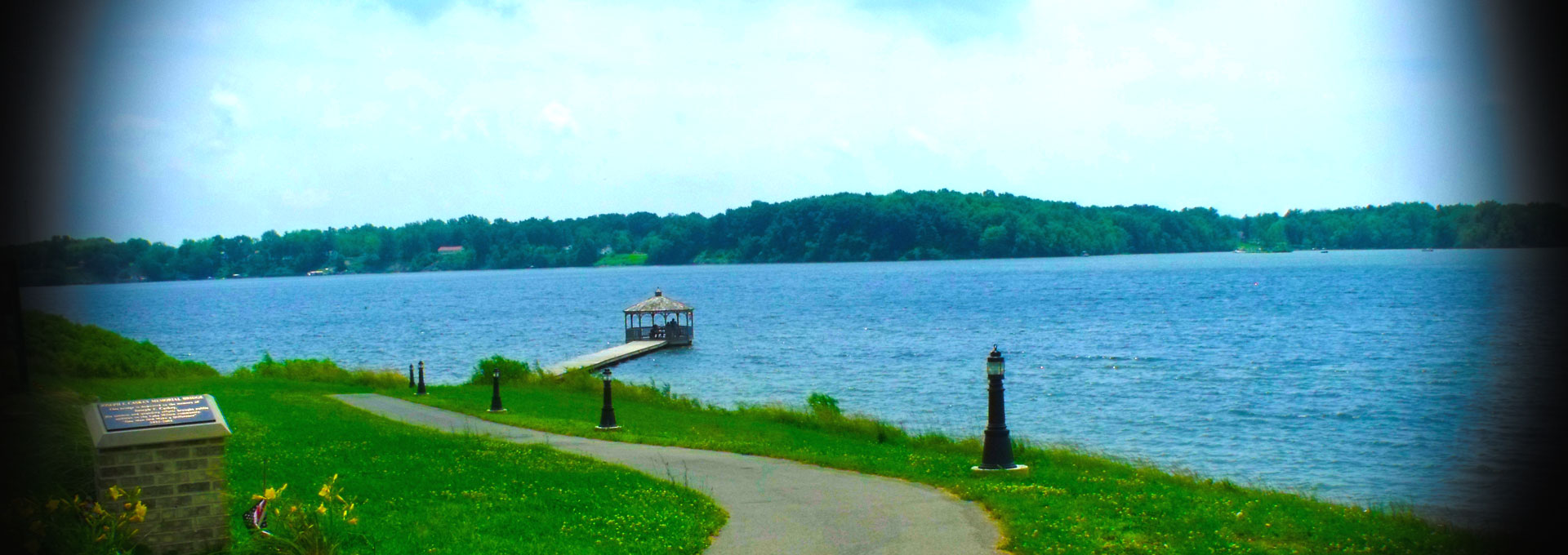
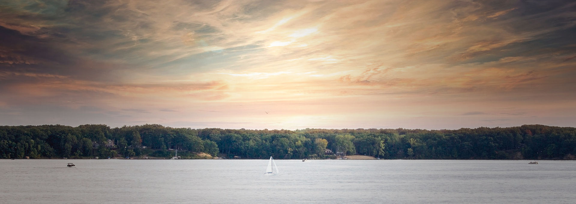
Township Bio Township Bio Newsletter Contacts Pictures Calendar of Events Links Administration Fire Police Road and Cemetery Zoning


MILTON TOWNSHIP HISTORY

LOCATION
Milton Township is located on the north west corner of Mahoning County, Ohio. It is bordered to the North by Trumbull County and to the West by Portage County.

NATIVE AMERICANS
Long before any white man set foot in this territory it was the home of the Erie Indians who were also known as the “Cat Nation” because their fierce fighting skills resembled that of the many wild cats that roamed this area. The Erie Nation was a peaceful group of hunters and farmers who lived in peace until the year 1653 when the Iroquois Confederacy which was also known as the Six Nations waged war against the Eries. No one knows for sure the true reason for this war but many believe that the Six Nations who lived in Northern Pennsylvania and New York were being crowded out by the colonists and needed to secure new hunting grounds. The Iroquois armed with guns supplied by the Dutch and English colonists easily defeated the Eries whose only weapon was the bow and a few poison arrows. The Eries were pushed west of the Mississippi River and for the next 100 years this area had no permanent residents. The names of the various Indian tribes who later wandered throughout the Mahoning Valley include the Miamis, Mingos, Chippewas, Shawnees, Wyandottes and the Mississaugas who were of Delaware stock and not warriors but hunters which explains why no permanent villages were established.

EXPLORATION
In 1670, Cavalier LaSalle was the first white man known to have explored the Western Reserve. Ten years after the pilgrims landed at Plymouth Rock, King Charles the 1st of England conveyed to the Earl of Warwick’s Corporation, known as the Council of Plymouth, the vast tract of land that included the Mahoning Valley. In 1755 the Middle British Colonies sent a map maker, Lewis Evans, to explore the area west of the Allegheny Mountains. While traveling through the territory that would soon become the Western Reserve he marked with a star the location of a salt lick. This salt lick was known to the Indians of the area since ancient days and gave the county its name. MA-HO-NIK is the Indian word for “at the salt lick”. This salt lick is located very near Salt Springs Rd. and State Route 46 near Mineral Ridge, Ohio. When Lewis Evans took his survey information back to Philadelphia it was printed into the “1st Map of the Middle British Colonies in America” by then printer Benjamin Franklin. Some historians believe that Lewis Evans never actually surveyed this area but instead got his information from a 1747 survey made by William Franklin, son of Benjamin, who was accompanied by George Croghan.

THE WESTERN RESERVE
Armed with this first map, each of the colonies began to claim territories outside of their set boundaries, many of which overlapped. In 1777, Congress set up rules about territorial claims. By 1780 New York had surrendered her territorial claims to the federal government and one after another of the states followed New York’s example. By 1786, only Connecticut remained outside the fold when she surrendered all claims northwest of the Ohio River except the Western Reserve. Connecticut’s Western Reserve stretches 120 miles westward from the Pennsylvania Line and southward from Lake Erie to the 41st parallel. This approximately 5000 square miles of land was established for war veterans and homesteaders. The exception being the “Fire Lands”, a section on the far west which was reserved for the people of Norwalk and Fairfield Connecticut whose homes had been burned by the British during the American Revolution.

LAND SALE
In 1786 and again in 1793 Connecticut thought about surveying and selling these lands. Nothing came of this until after General Anthony Wayne defeated the Indians in Ohio and had signed the Treaty of Greenville in 1795. Connecticut then decided to sell the Western Reserve and use the money for a perpetual fund of which the interest would be used to fund Connecticut schools. By September 2, 1795, 35 men calling themselves the Connecticut Land Company acquired the land for $1.2 million. They named Moses Cleveland their General Agent and put him in charge of surveying the tract into townships each to be 5 miles square. In April of 1796, Moses Cleaveland and 50 men left New York. They followed a northern route up and around the Allegheny Mountains and arrived at Conneaut on July 4, 1796. At nearly the same time John and Mary Young’s party left New York. They took a southern route to Philadelphia and crossed Forbes Road to Pittsburgh. They followed the Ohio River to the Beaver River, then along the Mahoning River. They settled on the banks of the Mahoning River on June 27, 1796 making Youngstown the first settlement of the Western Reserve.

SETTLEMENT
The original settlements in Milton Township were made in 1803 when Nathaniel Stanley and Aaron Porter followed the Mahoning River as far as was navigable and settled along opposite banks just above Pricetown. Aaron Porter who would later become a famous hunter, located on the west side of the river. Shortly, John Van Netten and his family arrived from Delaware and built a cabin in the western part of the township. It is thought that Mrs. Van Netten was the first working girl in the township for in her travels from the east she acquired a spoon mold, folks would bring their broken pewter ware which she would melt down to form new spoons. Jesse Holliday arrived in 1804 and erected a grist mill, sawmill, and carding mill. The grist mill was a remarkable size for the times. It was a two story structure which measured 34 feet by 40 feet and contained an undershot wheel that measured 22 feet in diameter. Judge Robert Price became the owner of these mills about 1817 and gave his name to the settlement. Later industries were a linseed oil plant, flax mill and woolen factory. Thomas L. Fenton was the first tavern keeper. Booth and Elliott were probably the first merchants. Dr. Tracy Bronson and Dr. George Ewing were the first practicing physicians, and Fenton, the tavern keeper, was also the first blacksmith. A post office was established there about 1808. There were also early tanneries and distilleries scattered throughout the township. Pricetown had reached its best days by 1840. Today there is little left of that part of the old village that lay in Milton Township. Even more tragic was the fate of Fredericksburg, once a flourishing village on the Mahoning River at present day Ellsworth Road. Once a stagecoach stop on the Cleveland-Pittsburgh route and a place of taverns, stores and mills, Fredericksburg is now buried beneath the waters of Lake Milton. In the first thirty years or more after its settlement, Milton Township flourished. Fertile and well drained lands made it a desirable place in which to live. It is a township of much natural beauty in the winding Mahoning River Valley, and it is located but a short distance from the village of Deerfield, in Portage County, which was one of the most thriving settlements on the Western Reserve in the early days.

SCHOOLS
Schools were established in Milton Township before 1810. Daniel Depew was probably the first teacher. James Johnston taught from 1811 to 1813 in a log house near the Jackson Township line, this building being used until 1818 when a structure of hewn logs was erected. Over the next 100 years Milton Township grew to have seven schools: The Schrader’s Corners, in the southeastern part; Orr’s Corners, in the eastern part; Tiger School, in the northeastern part; Center School; River Bank, on the east side of the river and south of the center; Fredericksburg School and Patterson School, on the west side of the river and north of the Center. A 1914 school code eliminated all but the Schrader’s Corners, Tigers, River Bank and Patterson schools. Later the Patterson school was closed, leaving only the three one-room schools with an attendance of seventy-five. The township had not yet been convinced that it could afford one centralized school, a movement toward this having been defeated by popular vote in 1916.

CHURCHES
The earliest church in the township was the Presbyterian, founded in about 1807. A church structure was erected soon afterwards at Pricetown, with James Boyd as first pastor and later activities were transferred to Orr’s Corners, but eventually abandoned. The Methodist Episcopal Church was organized in 1812, services were held at homes and in schoolhouses by circuit riders. Subsequently a church was erected at Baldwin’s Corners, but Methodists in Milton were soon identified with the Milton-Newton church at Pricetown, the building being on the Newton Township side of the line. The Disciples Church was organized in Milton about 1830 and flourished for a generation but finally dissolved.

GOVERNMENT
Governmentally, Milton Township was originally united with Newton Township, in about 1815 Milton Township was separately organized. Through the end of the 1800’s the fertile farmlands of Milton Township continued to flourish and the wild, deep and remarkably picturesque gorge of the Mahoning River continued its uninterrupted flow.

THE LAKE
In the early 1900’s Milton Township was the most sparsely populated of all Mahoning County Townships but it was destined to become a most important subdivision with the development of the Milton Lake property. Downstream the City of Youngstown was using the Mahoning River as both an industrial and domestic water supply. By 1906 this growing city was experiencing water shortages. The idea was born to create a reservoir upstream thus enabling some control over the flow of the Mahoning River. In 1908, Youngstown began purchasing land in Berlin Township. By 1910, land speculators now aware of the city’s plan for a reservoir drove the price of land up forcing Youngstown to abandon its Berlin land purchase. From 1911 to 1913, Youngstown executed its Milton land acquisition of 3,416 acres. The building of Milton Dam began in 1913 and by its completion in 1917 the city had spent $787,000 for this 1,685 acre lake. All was well until 1925 when the State Health Department condemned the water of the Mahoning River as it flowed through Youngstown as unsafe to drink. Plans were immediately put into place for a new domestic water supply and the Meander Reservoir, 10 miles east of Milton, was completed in 1932. Milton Dam still had an important job to do as it continued to control the flow of water to the vast industrial complexes downstream. So important in fact that during WWII a guard was posted at the dam to insure our nations steel production was not interrupted. As an extra precaution, Berlin Lake was formed upstream in 1943. During the next 40 years under the watchful eye of the Army Corp of Engineers and later the Ohio Department of Natural Resources, inspections and upgrades were made to the dam as deemed necessary to insure its stabilization. By 1984 there was little doubt the dam was failing. In early 1986, Milton Dam was breached and a lush green growth began to fill its bed. Youngstown relinquished control of the dam to the Ohio Department of Natural Resources. The Ohio Department of Natural Resources began construction of a brand new dam which it completed in 1988. The dam is 2840 feet in total length. The west wing is 325 feet, and the east wing is 1837 feet, each of these earthen concrete covered wings have an average base width of 160 feet. The center cement portion is 678 feet in length with a base width of 60 feet. There are four 36” gates which control this gravity fed dam. The crest of the dam is 951 feet above sea level with the optimum summer pool being 948 feet above sea level. Compare this with the Mahoning River in Youngstown at 839 feet or Lake Erie at 571 feet above sea level. Lake Milton is Ohio’s 72nd State Park. It was officially dedicated in June of 1988. The park consists of 1685 acres of water and 1171 acres of land.

POPULATION
By 1840 there were 1277 persons living in Milton Township. This total decreased each year until 1920, just after completion of the reservoir, when only 514 people remained. The period from 1920 until 1940 saw a large gain in summer cottages but a much smaller gain in permanent homes. Then in the 1940’s employment at Ravenna Arsenal and wartime gasoline rations influenced a movement to permanent residences. After WWII, increased interest in recreation and improvements in boating continued this movement. It was during this time that the demand for city cottages was so great that a rental freeze went into effect. From 1950 to 1960 the population increased 52.3% in Milton Township (2194 to 3341 persons) and 100.2% in Craig Beach Village (569 to 1139 persons). The 2000 census shows the population of Milton Township to be 4107.


Township history provided by Captain Mary Kay Amodio


Site Designed By Saletionships